Google takes street view for a dive

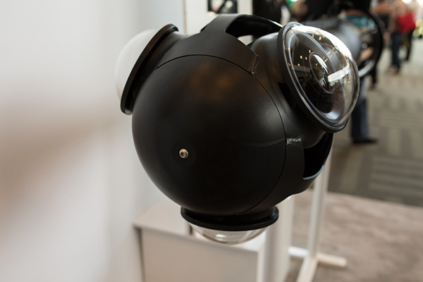
TechCrunch has published an articleabout Google’s ongoing project to add “Street View” style imagery from the underwater realm. Google’s recent I/O conference included a presentation from the Catlin Seaview Survey team, and details have been made public of how the team’s imaging scooters create the underwater mapping. During each hour-long dive, the divers travel around 2km and capture between 3,000 to 4,000 images. Each scooter has three cameras, oriented in a Y formation, and controlled via a tablet mounted on the rear of the scooter.
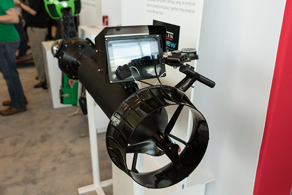
There are currently 4 of the $50,000 dollar systems in existence, although the team are looking into the possibility of using autonomous underwater vehicles for the future.
Survey operations are focusing in the Americas at present, but there are plans to expand the survey area significantly over the next three years. As to the reasons for such a project, project director Richard Vevers pointed out in his address during the conference that it is a powerful tool to get people to engage with the environmental challenges facing the world’s oceans. He says: “People don’t want to protect anything they can’t see,” and “most people don’t dive, but there’s no reason why we can’t take them diving virtually”.